|
CONTACT DETAILS |
E-MAIL: [email protected]
BOARD: 902 712 5355 (40 Lines)
UTTARAKHAND : +91-9719426260
NEW DELHI : +91-98 11 805373

|
|
TOURIST PLACES NEAR UTTARAKHAND:
Kumaun Tourist Places In Uttarakhand
Tourist Places Around Kumaun
Few important tourist places around Kumaun are:

Nainital
Nainital jumble around illustrious Naini Lake is a venerate hill station in Kumaon Uttarakhand. The 1.5km boardwalk known as the Mall leads to Mallital (Lake's Head) at the northwestern end of the lake. Maximum Nainital hotels, resorts, restaurants are hooked along the Mall Road between Mallital and Tallital. |

Corbett
Jim Corbett National Park is one of India's most beautiful wildlife parks here in Uttarakhand. Situated in the foothills of the Himalayas, in the newly created state of Uttarakhand is haven for wildlife lovers in India. The present area of the Corbett park is 1318.54 sq. km. including 520 sq. km. of core area of and 797.72 sq. km. of buffer area. |

Munsiyari
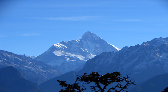
Munsiyari is a comely hamlet situated in the Pithoragrh district of Uttarakhand state, previously known as Uttaranchal. Munsiyari is nestled in the snow capped peaks of the Himalayas affording splendid vistas of natural beauteousness. Munsiyari is perched at an altitude of 2,298mts above sea level. |

Bageshwar
There are some of the most popular places to see near bageshwar and places to visit around bageshwar where you love spending your time and bageshwar tourist attraction would compel you to come here over and again.The trekking route to the pindari glacier traverses along the southern wilderness of the Nanda Devi Sanctuary offering captivating and invigorating views of peaks like Panwali Dwar (6683m) and Maiktoli (6803m). |

Mukteshwar
Mukteshwar is a town and tourist destination in the Nainital district of Uttarakhand, India. It sits high in the Kumaon Hills at an altitude of 2286 meters (7500 feet), 51 km from Nainital, 72 km from Haldwani, and 343 km from Delhi. |

Lohaghat
Lohaghat is an admired destination in Champawat district of Uttarakhand state. Lohaghat holds immense historical and mythological importance and it is situated on the banks of Lohawati River at an altitude of 1745mts above sea level. During summers the area is covered with Rhododendron, the state flower of Uttarakhand. Lohaghat is spread over ab area of approximately 4.5sqkms. |

Chaukori
Chaukori is a small hamlet situated in the Pithoragarh district of Uttrakhand state. Tibet lies to the north of Chaukori and to the south is Terai. Chaukori is perched at an astounding elevation of 2,010mts above sea level affording splendid and invigorating views of nature beauteousness. Chaukori is famous for its tea gardens established by the British. Chaukori is considered as heaven in Kumaon by the travelers. The virgin beauty of Chaukori is unaffected by pollution and crowd. |

Kausani
Kausani is located 52 km north of Almora. There are very few places in the Himalayas that can compare with the beauty of Kausani - a picturesque hill station famous for its scenic splendour and its spectacular 300 km-wide panoramic view of Himalayan peaks like Trisul, Nanda Devi and Panchchuli. |

Binsar
Binsar is situated amidst Binsar Wildlife Sanctuary. Binsar is an ideal destination for writers, nature lovers and adventure lovers. The dense Binsar Wildlife Sanctuary is the home of 200 bird species.Binsar is surely one of the most delightful places to visit. |

Champawat
The people of�Champawat�are rich in cultural heritage and they still perform the rituals and fairs with equal interest, which they used to perform in 10th century. Champawat is one of the easternmost town of Uttarakhand state perched at an elvation of 1,670mts above sea level.Champawat has a wide variety of fauna and flora as almost 65 per cent of the district is covered with fauna and flora. |

Almora
Almora�is famous for its magnificent beauty, panoramic view of the Himalayas, rich cultural heritage, unique handicrafts and delicious cuisine. Almora is perched at an elevation of 1,638mts above sea level and is spread across a 5-km ridge atop Kashaya Hill. Almora district is surrounded by Pithoragarh to the east, Garhwal region to the west, Bageshwar to the north and Nainital to the south. Almora is situated on a horse shoe shaped ridge of a mountain, the eastern portion of which is called the Talifat and the western one is known as Selifat. |

Ranikhet
Ranikhet indeed has a breath-taking and pristine charm. The tranquility and beauty of this place is unmatched and unscathed. Away from the hustle-bustle of popular hill stations in India, this is a perfect destination for those who are looking for a calm and peaceful holiday. Amongst the beautiful scenic vista of Ranikhet lie some beautiful places and scared temples that are worth visiting. |
Garwal Tourist Places In Uttarakhand
Tourist Places Around Garwal
Few important tourist places around Garwal are:

Rishikesh
Rishikesh, literally means Lord of the Senses, stands for Lord Vishnu and the city is blessed with the flowing of Holy Ganges. The city is a hub of many ancient and new temples, attracting thousands of pilgrims throughout the year. The popular belief of Hindu devotees is that performing austerities in this holy town and offering prayers in the holy temples brings the much needed attainment of , the salvation.� |

Dehradun
The city of Dehradun is the capital of Uttaranchal and the headquarters of Dehradun district. Dehradun is surrounded by the Himalayas in the north, the Shivalk Hills to the south, the Yamuna to the west and the Ganga to the east. Dehradun is the gateway to the famous hill station of Mussoorie and the pilgrimage spots of Haridwar and Rishikesh |

Chakrata
Chakrata is a cantonment town in Dehradun district in the state of Uttarakhand, India.It is situated between the Tons and Yamuna rivers, at an elevation of 7000 �7250 feet, 98 km from state capital, Dehradun, it was originally a cantonment of British Indian Army. Due west lies Himachal Pradesh, and due east are Mussoorie (73 km), Garhwal. |

Mussoorie
Mussoorie, a picturesque hill station in the Northern part of India, was discovered in the 18th century by Captain Young. The British officials added to the popularity of this hill station, as they mostly visited it as a getaway from the heat during summer.�Mussoorie is located at an altitude of 2000 meters above sea level, on ahorseshoe shaped ridge. This altitude gives the destination cool and pleasant climate conditions. |

Dhaunaulti
Dhanaulti is situated 25kms from Mussoorie amidst thick alpine forests of deodar, rhododendron and oak and it offers an atmosphere of perfect peace & tranquility. Dhanaulti often brings surprise for the tourists as the beauty of Dhanaulti is yet to be explored and is less popular amongst people. The woods, cool environment, scenic valleys, lovely weather and enchanting view of snow capped peaks of majestic Himalayan range makes it an ideal retreat for a relaxed holiday. Dhanaulti is situated on the Mussoorie - Chamba route. |

New Tehri
New Tehri is the only planned hill township of Uttarakhand which was made during the construction of the Tehri dam. Every month thousands of tourists visit Tehri to see the stagnant water of the massive Tehri Dam. The Dam is situated amidst high mountains many of which are submerged under water. New Tehri is very well connected with motorable roads. Tehri is situated 69kms from Mussoorie. There are many good hotels in New Tehri. |

Auli
Auli Tourism is the most popular skiing destination of Uttaranchal state. Auli is situated in Chamoli district of Garhwal region covering elevation from 2,519mts to 3,050mts above sea level. Auli is a "bugyal" which means meadow in the regional language. Auli is often compared with best ski resorts of the world y foreigners.� |

Joshimath
Joshimath is a popular hill station and a famous centre for pilgrimage at a height of 1,890mts above sea level in Chamoli district of Garhwal division in Uttaranchal. In ancient scriptures Joshimath is described as Kartikeyapura as it has been named after Kartikeya, the God of Katyuri kings. Joshimath is one of the four maths or monasteries established in the 8th century by Adi Guru Sri Shankaracharya. |

Badrinath
Badrinath Tourism Sandwiched between Nar and Narayan mountain ranges, Badrinath in the Chamoli district of Uttarakhand is naturally bestowed with pristine surroundings. |

Gangotri
Gangotri is the highest temple of Goddess Ganga and one of the four dhams of Uttarakhand state. Gangotri is situated at an elevation of 3,048mts above sea level at a distance of 21kms from Harsil. Gangotri offers scenic splendors of rugged terrains, gushing water of Bhagirathi River and snow laden Himalayas.. |

Hemkund Sahib
Hemkund Sahib is situated at an altitude of 4,329 mts above sea level in Chamoli district of Uttarakhand state. Hemkund literally suggests lake of snow and the pristine water of this lake is as cold as snow. Numerous waterfalls, dense forest, enchanting view of the Himalayas, crystal clear lake and the holy Hemkund Sahib are the key highlights of this trekking trip. The weather changes very rapidly at Hemkund Sahib. |

Uttarkashi
Uttarkashi meaning Kashi of the north, is a town in Uttarakhand, India. It is the district headquarters of Uttarkashi district. Uttarkashi is situated on the banks of river Bhagirathi at an altitude of 1352 m above sea level. Uttarkashi is home to a number of ashrams and temples and also to the Nehru Institute of Mountaineering. |
|
|
|